| Loading ITables v2.4.4 from the internet... (need help?) |
Data Catalogue
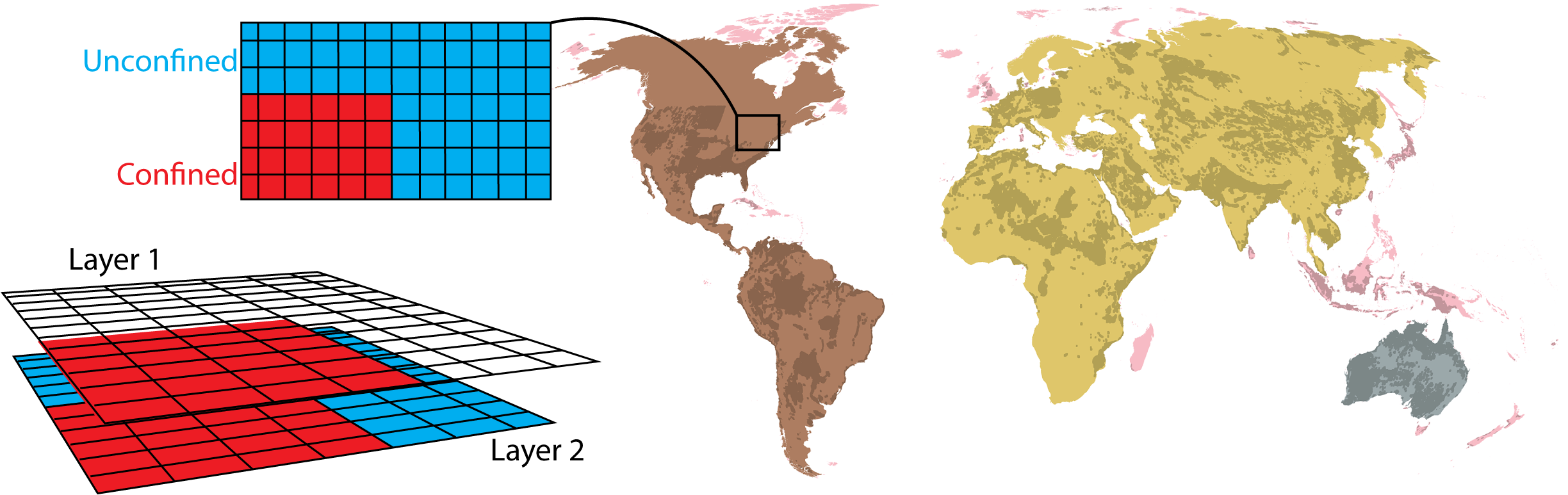
GLOBGM employs a two-layer groundwater model, with outputs available for both layers. Layer 1 (l1) represents the shallow, unconfined aquifer system (potentially including a confining unit), while Layer 2 (l2) models the deeper, confined aquifer. Properly interpreting these layers is essential for selecting the appropriate data in your analysis.
The aquifer type at any location is determined by the data presence in each layer:
Confined System: Occurs where Layer 1 contains valid data, representing the confining layer (aquitard), with Layer 2 data corresponding to the underlying confined aquifer.
Unconfined System: Identified where Layer 1 is null (no data) and Layer 2 has valid data, indicating an unconfined aquifer in Layer 2.
Tables below are provide the filenames and general overview of the data package. Filenames are clickable and will redirect to the YODA repo containing the data. In addition, direct downloads are possible via the download button.
| Loading ITables v2.4.4 from the internet... (need help?) |
Ensemble
| Loading ITables v2.4.4 from the internet... (need help?) |
GCM
| Loading ITables v2.4.4 from the internet... (need help?) |
Ensemble
| Loading ITables v2.4.4 from the internet... (need help?) |
GCM
| Loading ITables v2.4.4 from the internet... (need help?) |
| Loading ITables v2.4.4 from the internet... (need help?) |